🌍 🛰️ Earth Scientist and Geospatial Product Developer / Owner
Geospatial software engineer and scientist working in Earth observation, 3D terrain analysis, natural capital quantification from space, flood risk mapping, image processing and fluvial geomorphology
Past Projects (Click below!)
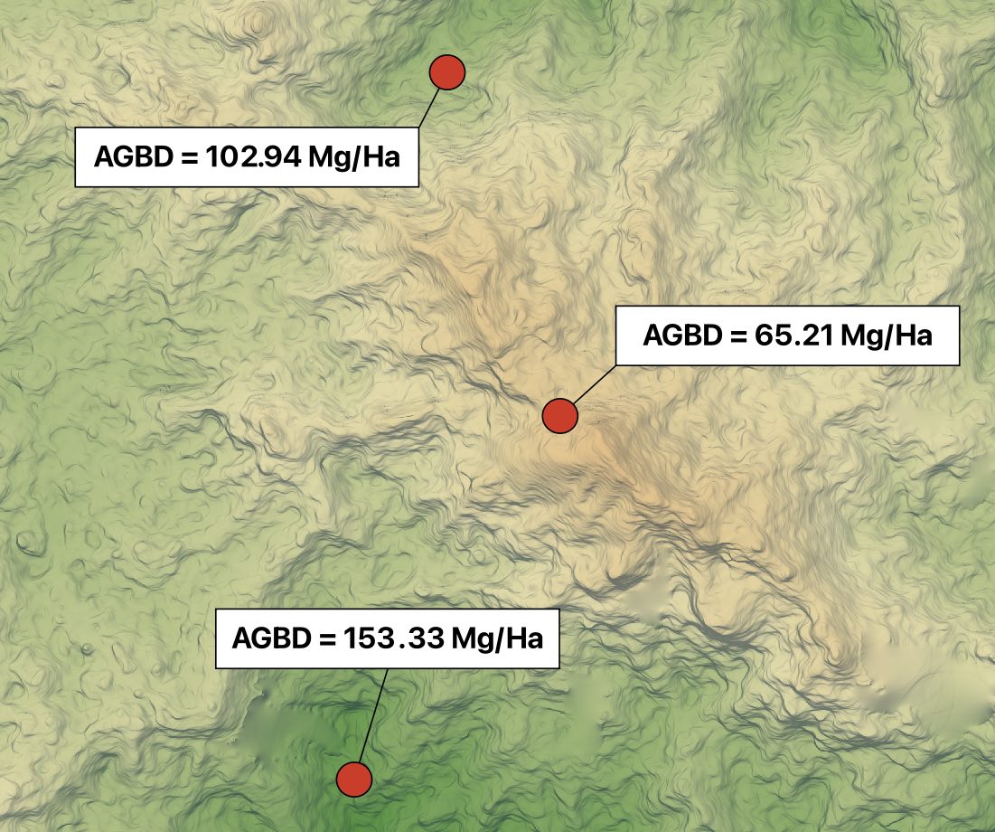
- Biomass Estimation using Terrain Data & Allometic Models
- Building a Global River Avulsion Database
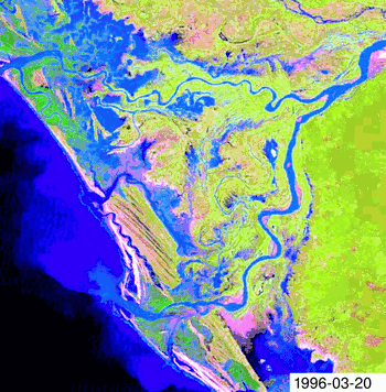
- Tracking River Migration from Space
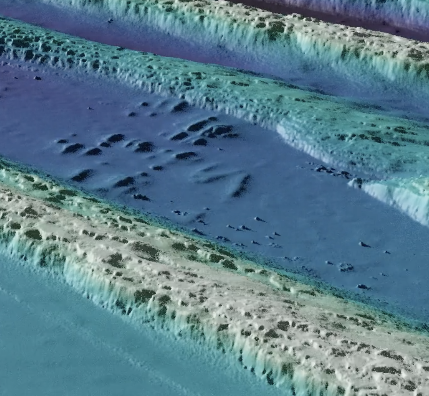
- Sand Dune Tracking using Machine Learning and 3D Models
- Long-Exposure Multispectral Earth Obs. for Geological Mapping
- Palaohydraulic Reconstruction in Death Valley
- 3D Renders of DEMs in Blender
- SatGuesser! -- a quick Geospatial React Game 🔎 🌍
Geospatial & Web Application Stack
Front End |
Middleware |
Back End |
|---|---|---|
|
|
|
Interests / Proficiencies
Earth observation, scalable geospatial pipeline design, photogrammetry, LiDAR & DEM processing, geomorphology, hydrology, granulometry, image processing, data analysis and machine learning
Programming Languages
Python, Javascript/Typescript, R, Ruby, SQL, R, Bash, C++, MATLAB
Tools and Software
GDAL, JupyterLab, Anaconda, Docker, QGIS, VSCode, GeoParquet, COGs, Grass GIS, Saga GIS, Rails, Git, Blender, NodeJS, STAC, React, Heroku, PostGIS, AWS, JIRA
Python Libraries
Rasterio, Geopandas, Dask, XArray, Scikit-Learn, Jupyter, Numpy, Shapely, Seaborn, OpenCV, Tensorflow, FastAPI, PyArrow, SciPy, PySTAC, XGBoost
- Current Location: Liverpool, UK
⛰️ I am an Earth scientist and software developer with a keen interest in deploying scalable software solutions for monitoring the Earth's surface using remote sensing, mapping technology and landscape evolution models.
🎓 My academic background is in sedimentology, fluvial geomorphology and remote sensing.
🛠️ I have been a web-developer since I left school, with experience developing applications and dashboards in React, Rails and Plotly/Dash. I am comfortable in the front end UX/UI space, server side and database layers.
🧑💻 Professionally, I have been developing numerical models, applications and algorithms to efficiently process Earth and space data at scale to solve problems in flood risk, natural capital mapping and land use change.
🐱 I like cats, real time strategy games, sketching and DIY!
- Current Employer: Terrabotics Ltd.
- Current Location: Liverpool, UK
⛰️ I've been an Earth scientist and software developer 7 years post-PhD with a keen interest in monitoring the surface of the Earth using remote sensing and landscape evolution models to better map and measure risks and responses to climate forcings.
🎓 My academic background is in sedimentology, fluvial geomorphology and remote sensing.
🧑💻 Professionally, I have been developing numerical models, algorithms and data pipelines to efficiently process Earth and space data at scale to solve problems in flood risk, natural captial mapping and land use change.
🐱 I like cats, real time strategy games, sketching and DIY!
Selected Projects:
Biomass Estimation using Terrain Data & Allometic Models
Testing Mechanistic Theory and Building a Better a Global Avulsion Database Using Space Data
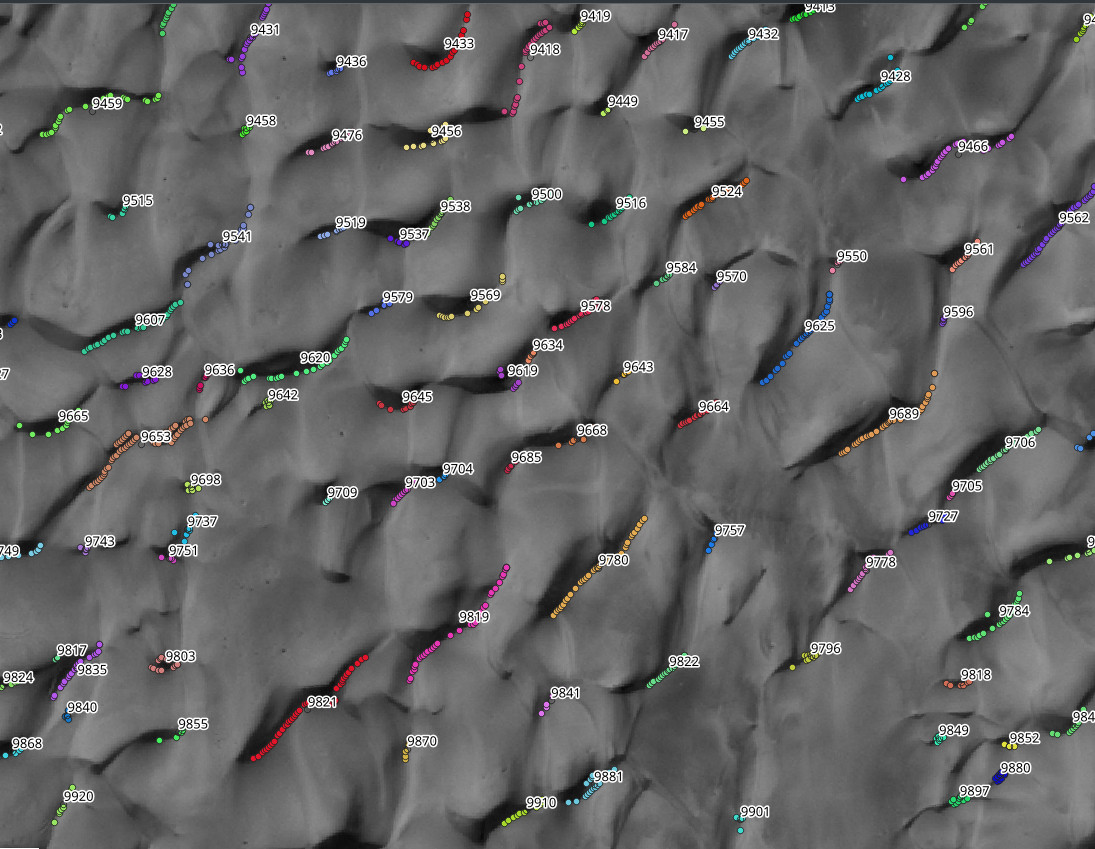
Sand Dune Tracking using Machine Learning and 3D Models
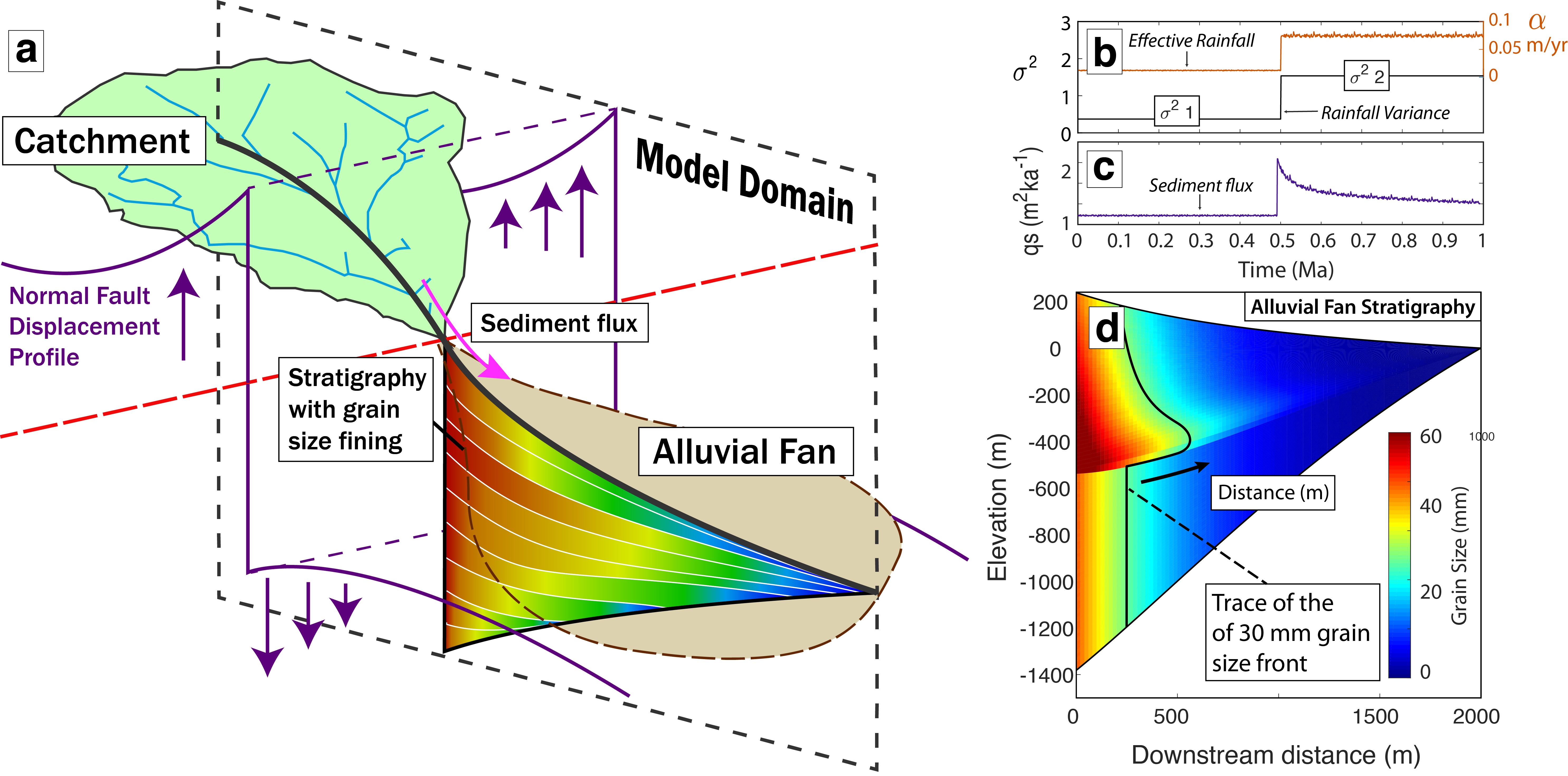
Palaohydraulic Reconstruction in Death Valley
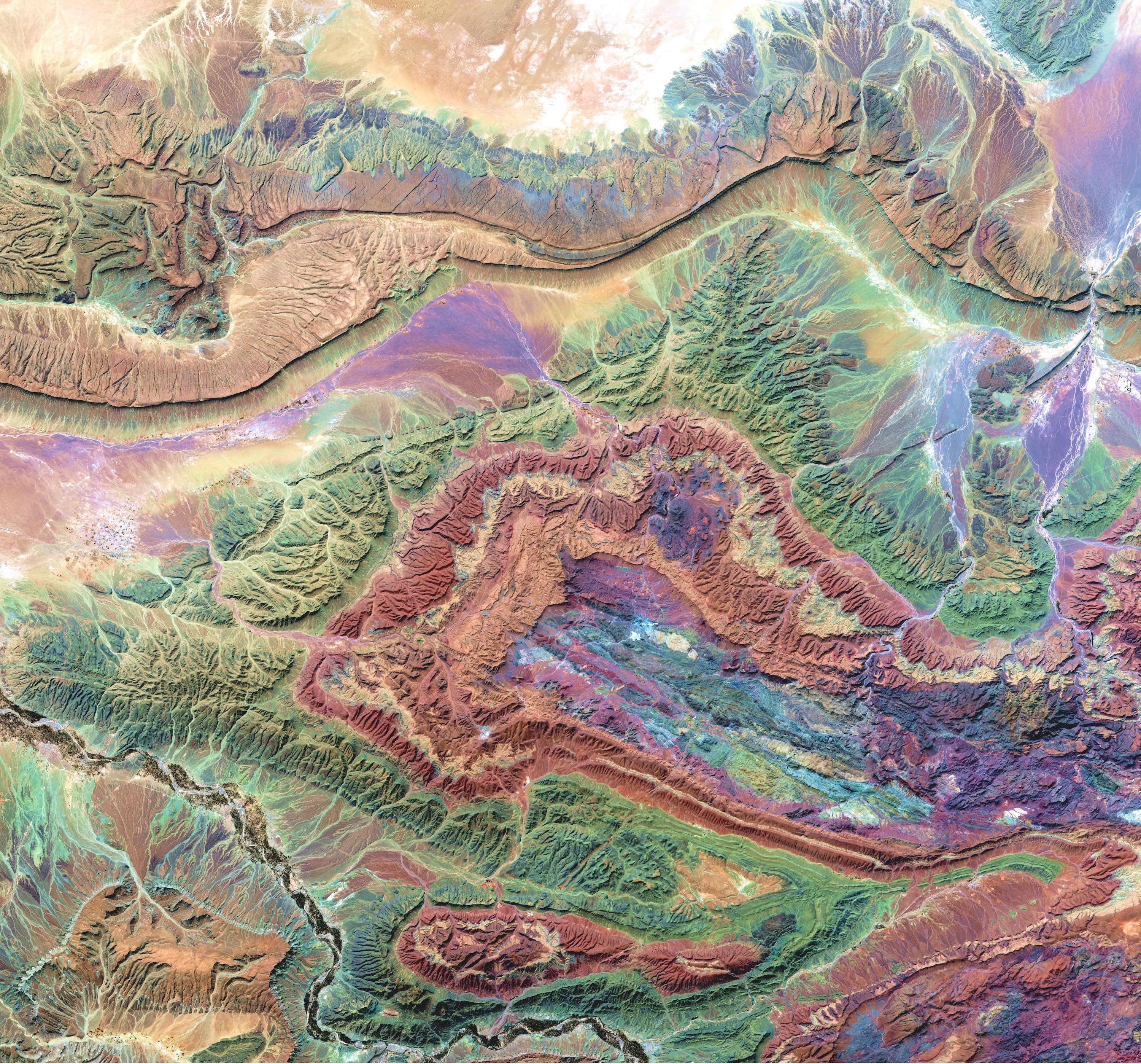
Long-Exposure Multispectral Earth Observation for Geological and Land Use Mapping
Contact
Contact me on LinkedIn or via my email:
sam[at]tuta.io
copyright (c) Sam Brooke 2025 | built in Javascript + ThreeJS